


ALLENS GROVE 1 Voting District, Mason County, Illinois
About
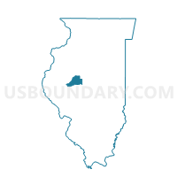
Outline

Summary
| Unique Area Identifier | 573525 |
| Name | ALLENS GROVE 1 Voting District |
| County | Mason County |
| State | Illinois |
| Area (square miles) | 35.77 |
| Land Area (square miles) | 35.72 |
| Water Area (square miles) | 0.04 |
| % of Land Area | 99.88 |
| % of Water Area | 0.12 |
| Latitude of the Internal Point | 40.28278590 |
| Longtitude of the Internal Point | -89.66362360 |
Maps


Graphs
Select a template below for downloading or customizing gragh for ALLENS GROVE 1 Voting District, Mason County, Illinois


Neighbors
Neighoring Voting District (by Name) Neighboring Voting District on the Map
- MALONE Voting District, Tazewell County, IL
- MANITO 1 Voting District, Mason County, IL
- MASON CITY 1 Voting District, Mason County, IL
- MASON CITY 3 Voting District, Mason County, IL
- PENNSYLVANIA Voting District, Mason County, IL
- PRAIRIE CREEK Voting District, Logan County, IL
Top 10 Neighboring County Subdivision (by Population) Neighboring County Subdivision on the Map
- Mason City township, Mason County, IL (2,633)
- Manito township, Mason County, IL (2,466)
- Allens Grove township, Mason County, IL (586)
- Prairie Creek township, Logan County, IL (487)
- Malone township, Tazewell County, IL (220)
- Pennsylvania township, Mason County, IL (206)
Top 10 Neighboring Place (by Population) Neighboring Place on the Map
Top 10 Neighboring Elementary School District (by Population) Neighboring Elementary School District on the Map
Top 10 Neighboring Secondary School District (by Population) Neighboring Secondary School District on the Map
Top 10 Neighboring Unified School District (by Population) Neighboring Unified School District on the Map
Top 10 Neighboring State Legislative District Lower Chamber (by Population) Neighboring State Legislative District Lower Chamber on the Map
Top 10 Neighboring State Legislative District Upper Chamber (by Population) Neighboring State Legislative District Upper Chamber on the Map
Top 10 Neighboring 111th Congressional District (by Population) Neighboring 111th Congressional District on the Map
Top 10 Neighboring Census Tract (by Population) Neighboring Census Tract on the Map
- Census Tract 219, Tazewell County, IL (4,677)
- Census Tract 9563, Mason County, IL (2,975)
- Census Tract 9530, Logan County, IL (2,593)
- Census Tract 9567, Mason County, IL (1,885)